Satellite Imagery Restrictions Spark Global Concerns
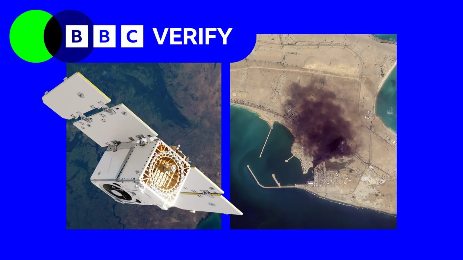
Leading humanitarian organizations and journalists have voiced significant concerns after a prominent satellite imagery company, Planet Labs, informed its users of new restrictions on access to images of Iran and large sections of the Middle East. This decision follows a direct request from the US government.
Indefinite Restrictions Imposed by Planet Labs
California-based Planet Labs initially implemented a 14-day delay on new imagery from the region in March. This policy has since escalated to an “indefinite” restriction. The company stated to BBC Verify that it is now transitioning to a system of “managed distribution,” where selected images will be shared “on a one-off basis until the security risk has abated.” However, the extent of these restrictions remains undisclosed, though BBC Verify’s access suggests they encompass most of the Middle East, including Iraq, Lebanon, Israel, and Gaza.
Impact on Journalism and Humanitarian Aid
The restrictions severely limit the ability of journalists, humanitarian organizations, and analysts to utilize satellite images for critical assessments. This includes evaluating the impact of regional conflicts, such as damage to military targets and civilian infrastructure. For instance, Oxfam, a charity, highlighted its reliance on satellite imagery for logistics during conflicts and disasters, particularly in Gaza, where Planet has also suspended coverage. Magnus Corfixen, Oxfam’s humanitarian lead, explained how imagery was crucial for assessing water systems in inaccessible areas.
Investigative journalist Benjamin Strick emphasized that satellite imagery is a vital tool for reporters, especially in “conflict zones, disasters and other restricted environments where reporters cannot safely access the scene or where information is tightly controlled.” News clients, including the BBC and The New York Times, are now seeking non-US based alternatives, though Christoph Koettl from The New York Times noted that these often lack the same level of detail and widespread coverage offered by Planet Labs.
US Pressure and Commercial Incentives
The specific reasons behind the US government’s request to Planet Labs remain unclear, with the Department of Defense not responding to comments. Planet Labs initially justified its 14-day delay by stating it was “to ensure our imagery is not tactically leveraged by adversarial actors to target allied and Nato-partner personnel and civilians.”
Bill Greer, a geospatial analyst and co-founder of Common Space, suggested that companies with military contracts, like Planet Labs, sometimes implement “voluntary compliance” requests that are, in fact, “driven by commercial incentive structures.” He noted, “When your largest customer is also the government that regulates you, the line between voluntary and involuntary gets very thin.”
Concerns Over Misinformation and Future Trends
The restrictions have also raised concerns about the proliferation of fake satellite imagery online. Amir Farhand, founder of Soar.Atlas, reported a “massive spike in fake satellite imagery during this conflict,” calling it a “serious problem.”
Todd Harrison, a senior fellow at the American Enterprise Institute, anticipates that such restrictions will become more common but ultimately more futile. He believes that the increasing democratization of dual-use technology will make the “modern battlefield more transparent for both sides than ever before,” a reality that governments will need to adapt to in their military planning.
#SatelliteImagery #MiddleEast #Iran #USGovernment #PlanetLabs #HumanitarianAid #Journalism #GeospatialIntelligence #ConflictZones #InformationAccess


Leave a Reply